As if Google Earth wasn't cool and useful enough -- like helping find a new apartment in a faraway city or taking a little tour of a foreign place -- Google's latest version of the program just upped the ante. Now you can view live weather patterns of rain and snow.
So far the precipitation data covers parts of North America and Europe, according to a Thursday Google Earth blog post by software engineer Quarup Barreirinhas.
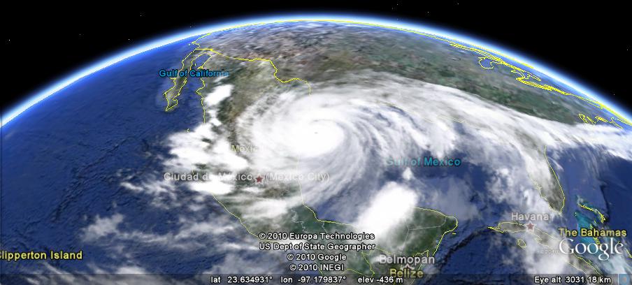
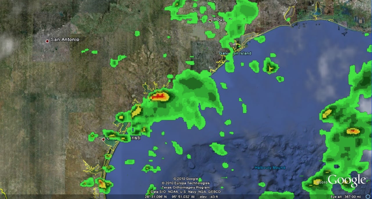
"This is a fun and useful tool for anyone planning to travel or who wants to check a specific area where a friend or relative might be visiting or living. For example, in preparation for my recent trip to the American southwest, I decided to check on the status of Hurricane Alex a few days in advance," Barreirinhas wrote. "Via Google Earth, I could see that the hurricane was entering Mexico and Texas. Zooming close to ground, I saw that the Texas coastline was getting a bit of rain." The newest version of Google Earth will let you track wet weather patterns, ranging from light drizzle to hurricanes and blizzards, Barreirinhas wrote.
So it's time to add another cool and useful role of Google Earth -- meteorologist. Images like those shown here might be a good indication that you should avoid Texas' east coast.
The weather feature is available in Google Earth 5.2 . The latest version also allows users to visualize a hiking or biking track, with the ability to view elevation and speed, by connecting a GPS device.