Google Earth now has live weather imagery

Emily Banks 0 Tallied Votes 545 Views Share

As if Google Earth wasn't cool and useful enough -- like helping find a new apartment in a faraway city or taking a little tour of a foreign place -- Google's latest version of the program just upped the ante. Now you can view live weather patterns of rain and snow.

So far the precipitation data covers parts of North America and Europe, according to a Thursday Google Earth blog post by software engineer Quarup Barreirinhas.

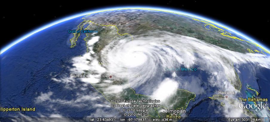
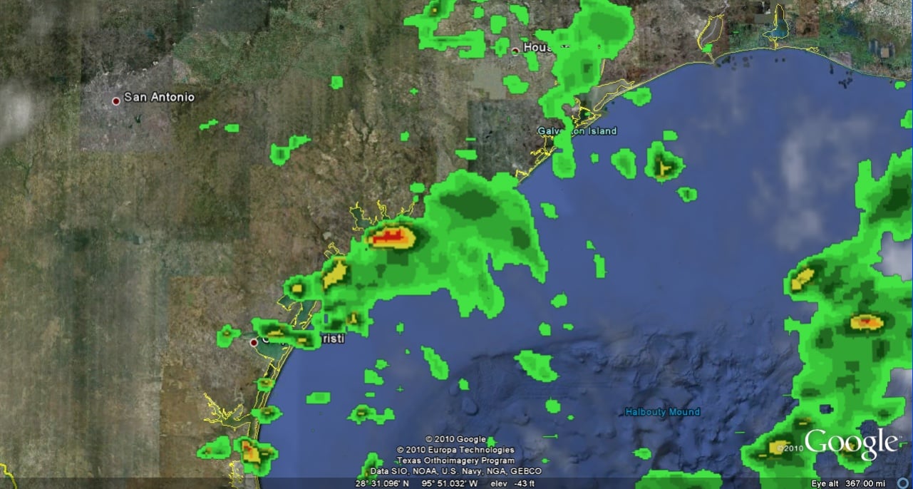
"This is a fun and useful tool for anyone planning to travel or who wants to check a specific area where a friend or relative might be visiting or living. For example, in preparation for my recent trip to the American southwest, I decided to check on the status of Hurricane Alex a few days in advance," Barreirinhas wrote. "Via Google Earth, I could see that the hurricane was entering Mexico and Texas. Zooming close to ground, I saw that the Texas coastline was getting a bit of rain." The newest version of Google Earth will let you track wet weather patterns, ranging from light drizzle to hurricanes and blizzards, Barreirinhas wrote.

So it's time to add another cool and useful role of Google Earth -- meteorologist. Images like those shown here might be a good indication that you should avoid Texas' east coast.

The weather feature is available in Google Earth 5.2 . The latest version also allows users to visualize a hiking or biking track, with the ability to view elevation and speed, by connecting a GPS device.
Dani AI

Generated

A few up-to-date notes to clarify what those screenshots and user guesses mean, and how to verify them today.

The hunch from and that the radar/precipitation imagery in ’s screenshots came from a commercial weather provider is correct: Google’s weather/ radar layers were supplied by third‑party weather services during that era (The Weather Channel was the primary partner used for conditions, forecasts and many radar tiles). (gisuser.com)

The cloud imagery and the precipitation/radar overlays are actually separate feeds: the cloud layer has historically come from the U.S. Naval Research Laboratory (processed satellite products), while the radar/precip layer was delivered as a network layer (tiles/animations) managed via the weather partner; radar coverage and update frequency vary by region (radar is normally behind real‑time by minutes). (gearthblog.com)

How to confirm the source and troubleshoot (practical steps): enable the Weather (or Clouds/Radar/Conditions) layer in Google Earth, click the layer’s Information/Details link (or open the network‑link properties in Places) to see the attribution and any animation download links; if precipitation doesn’t appear, check that the Radar sublayer is enabled, update Google Earth, and remember coverage was limited to specific regions. Those layer info panels are the quickest way to see who supplied a given overlay. (gearthblog.com)

If authoritative or downloadable radar/KML is needed (for research or embedding), the U.S. National Weather Service / NOAA publish many products as KML/KMZ and NOAA tools can export radar into Google‑Earth overlays; specialized services (NSSL/WDSSII and similar) also publish KML for multi‑sensor radar fields. Using those official KML feeds removes ambiguity about provenance and licensing. (wpc.ncep.noaa.gov)

Caveat: the Google Earth weather layers are intended for visualization — always rely on official forecasts and warnings from meteorological agencies for safety decisions.

Dani 5,664 The Queen of DaniWeb Administrator Featured Poster

Umm ... Can't you already do this exact thing from weather.com?

sagemore48 0 Newbie Poster

The pics. Were from the weather.com?

Be a part of the DaniWeb community

We're a friendly, industry-focused community of developers, IT pros, digital marketers, and technology enthusiasts meeting, networking, learning, and sharing knowledge.